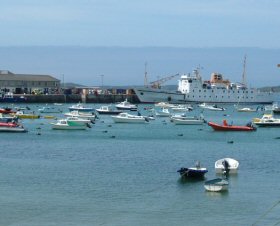
St. Mary's tide gauge site
The tide gauge is located on The Quay, Hugh Town, inside the ferry terminal store room.
Click here
to see a map of the site in a separate window.
Tide gauge location
The equipment is housed in a heated cabinet within the ferry terminal store room, with the full-tide and mid-tide pressure points being mounted on steelwork attached to the quay wall. The pressure points are located on the nose of the quay. All three pressure lines are monitored by the POL data logger.
 The tide gauge is levelled to the tide gauge bench mark supported by Ordnance Survey auxiliary marks.
External users
Sea level pressures and/or elevations from this site are supplied to the following authority:
- St. Mary's Harbour
Site history
1966 – Lea chart recorder float gauge installed
1989 – Gauge and building lost in a storm
1989 – Delay due to redevelopment of the quay which incorporated the new tide gauge
1994 – DATARING system installed with two full-tide and a mid-tide bubblers
2002 – POL data logger installed
| Location | |
| Latitude | 49° 55.071'N |
| Longitude | 6° 19.035'W |
| Grid ref | SV 9021 1090 |
| Earliest data | 1992 |
| Tidal levels | |
| HAT | 6.31 m |
| LAT | 0.09 m |
| MHWS | 5.68 m |
| MHWN | 4.35 m |
| MLWN | 2.04 m |
| MLWS | 0.73 m |
| H for 2024 | 6.27 m |
| L for 2024 | 0.12 m |
| H for 2025 | 6.17 m |
| L for 2025 | 0.21 m |
| MSR | 4.95 m |
| MNR | 2.31 m |
Abbreviations
HAT – highest astronomical tide
LAT – lowest astronomical tide
MHWS – mean high water springs
MHWN – mean high water neaps
MLWN – mean low water neaps
MLWS – mean low water springs
H – highest for year
L – lowest for year
MSR – mean spring range
MNR – mean neap range
Measurement devices
Tide gauge systemsFull-tide bubbler
Half-tide bubbler
Direct pressure transducer
Tide gauges
Ott pneumatic gauge
Munro float gauge
Wellhead float gauge
Lea float gauge
Instruments
DATARING logger
Datum probe