Tide clocks and watches are practical ways of indicating the state of the tide, in addition to consulting local tide tables.
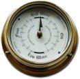
Tide clocks
Most tide clocks work by using a 12 hour 25 minute cycle. Generally in the UK and Ireland they vary in accuracy between plus or minus 30 minutes over a 30-day period. Therefore it is necessary to reset them using local tide tables every month or so.
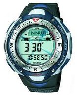
Tide watches
Some watches with a moon/tide mode require lunitidal intervals so that they can indicate high and low waters. There are two definitions for this interval, which depends on whether adjacent high waters, or the mean of high waters over a lunar month are being considered.
High water lunitidal interval
The high water lunitidal interval (or high water interval) is the time interval between the moon's transit and the next high water. The interval may be taken from the local time of moon's transit to the local time of high water, or it may be taken from the Greenwich time of the moon's transit to the standard time of high water.
Mean lunitidal interval
Also referred to as the mean high water interval, this is the mean value of all the high water intervals throughout at least a lunation of 29 days, and this is what is given below.
Lunitidal interval
The mean lunitidal intervals (mean high water intervals) are calculated using this equation:
interval (hours) = M2 phase (degrees) × M2 period (hours) / 360 (degrees)
Use the values from the table to set the moon/tide mode of your watch. These values should be sufficient information for watches that use the lunitidal interval to indicate high and low waters. The following list is ordered by adjacent locations around the coast.
Please note: Check your watch against local tide tables to confirm your setting. If your location in the UK or Ireland is not mentioned, try using the nearest one or average between the two nearest places on either side – however, this is not guaranteed to work. The usual disclaimer applies to any information given.
| Location | Latitude | Longitude | Interval (hr:mn) | |
|---|---|---|---|---|
| England – south | Avonmouth | 51° 30.4′N | 2° 43.2′W | 6:57 |
| Hinkley Point | 51° 13.0′N | 3° 7.4′W | 6:19 | |
| Minehead | 51° 12.9′N | 3° 28.3′W | 6:11 | |
| Ilfracombe | 51° 12.6′N | 4° 6.6′W | 5:36 | |
| Newquay | 50° 25.1′N | 5° 5.2′W | 4:53 | |
| St. Mary’s (Isles of Scilly) | 49° 55.0′N | 6° 18.7′W | 4:31 | |
| Newlyn | 50° 6.1′N | 5° 32.9′W | 4:36 | |
| Falmouth | 50° 9.4′N | 5° 4.2′W | 5:02 | |
| Plymouth (Devonport) | 50° 22.9′N | 4° 10.8′W | 5:19 | |
| Torquay | 50° 27.5′N | 3° 31.7′W | 5:51 | |
| Portland | 50° 35.6′N | 2° 26.2′W | 6:40 | |
| Weymouth | 50° 36.4′N | 2° 27.0′W | 6:36 | |
| Bournemouth | 50° 42.9′N | 1° 52.5′W | 9:24 | |
| Christchurch (Quay) | 50° 43.8′N | 1° 46.8′W | 10:37 | |
| Lymington (Entrance) | 50° 45.2′N | 1° 31.4′W | 11:02 | |
| Cowes (Isle of Wight) | 50° 46.1′N | 1° 17.9′W | 11:21 | |
| Southampton | 50° 53.7′N | 1° 24.3′W | 11:19 | |
| Portsmouth | 50° 48.8′N | 1° 6.1′W | 11:16 | |
| Littlehampton | 50° 47.9′N | 0° 32.5′W | 11:08 | |
| Shoreham | 50° 49.7′N | 0° 14.9′W | 11:06 | |
| Newhaven | 50° 46.9′N | 0° 3.5′E | 11:05 | |
| Dungeness | 50° 54.8′N | 0° 58.7′E | 11:14 | |
| Dover | 51° 7.6′N | 1° 20.2′E | 11:27 | |
| England – east | Margate | 51° 23.4′N | 1° 22.8′E | 11:47 |
| Sheerness | 51° 26.8′N | 0° 45.0′E | 12:12 | |
| Southend | 51° 31.7′N | 0° 43.0′E | 12:11 | |
| Coryton | 51° 30.7′N | 0° 32.5′E | 12:24 | |
| Tilbury | 51° 27.3′N | 0° 20.3′E | 0:18 | |
| North Woolwich | 51° 29.9′N | 0° 3.6′E | 0:44 | |
| London Bridge | 51° 30.5′N | 0° 5.3′W | 1:10 | |
| Shivering Sand | 51° 29.9′N | 1° 4.7′E | 11:59 | |
| Walton-on-the-Naze | 51° 50.7′N | 1° 16.5′E | 11:25 | |
| Harwich | 51° 56.8′N | 1° 17.1′E | 11:18 | |
| Mistley Quay (River Stour) | 51° 56.7′N | 1° 4.8′E | 11:30 | |
| Felixstowe | 51° 57.5′N | 1° 20.8′E | 11:05 | |
| Lowestoft | 52° 28.3′N | 1° 45.1′E | 8:57 | |
| Gorleston (Great Yarmouth) | 52° 34.3′N | 1° 44.3′E | 8:17 | |
| Cromer | 52° 56.1′N | 1° 17.7′E | 6:30 | |
| Hunstanton | 52° 56.4′N | 0° 29.2′E | 6:11 | |
| King’s Lynn | 52° 45.3′N | 0° 23.4′E | 6:34 | |
| West Stones (River Great Ouse) | 52° 49.7′N | 0° 21.5′E | 6:19 | |
| West Lighthouse (River Nene) | 52° 48.5′N | 0° 12.6′E | 6:17 | |
| Tabs Head (Rivers Witham/Welland) | 52° 56.0′N | 0° 5.0′E | 6:13 | |
| Roaring Middle Light (Wash) | 52° 58.6′N | 0° 20.9′E | 6:04 | |
| Gibraltar Point | 53° 5.3′N | 0° 20.0′E | 5:54 | |
| Skegness | 53° 8.7′N | 0° 20.9′E | 5:47 | |
| Boygrift | 53° 17.7′N | 0° 19.2′E | 5:38 | |
| Inner Dowsing Light | 53° 19.0′N | 0° 35.0′E | 5:35 | |
| Spurn Point | 53° 34.2′N | 0° 6.4′E | 5:12 | |
| Bull Sand Fort | 53° 33.7′N | 0° 4.1′E | 5:16 | |
| Immingham | 53° 37.9′N | 0° 11.2′W | 5:35 | |
| Hull | 53° 44.3′N | 0° 19.9′W | 5:59 | |
| Blacktoft | 53° 42.4′N | 0° 43.5′W | 6:58 | |
| Withernsea | 53° 43.6′N | 0° 2.6′E | 4:37 | |
| Scarborough | 54° 16.9′N | 0° 23.4′W | 3:49 | |
| Whitby | 54° 29.6′N | 0° 36.8′W | 3:35 | |
| River Tees (Entrance) | 54° 38.9′N | 1° 8.9′W | 3:18 | |
| North Shields (River Tyne) | 55° 0.6′N | 1° 25.8′W | 3:04 | |
| Scotland | Leith | 55° 59.4′N | 3° 11.0′W | 1:54 |
| Rosyth | 56° 1.3′N | 3° 26.7′W | 1:53 | |
| Aberdeen | 57° 8.7′N | 2° 3.6′W | 0:50 | |
| Moray Firth | 57° 36.0′N | 4° 0.4′W | 11:37 | |
| Cromarty Firth | 57° 41.1′N | 4° 2.1′W | 11:33 | |
| Wick | 58° 26.5′N | 3° 4.9′W | 11:07 | |
| Lerwick | 60° 9.3′N | 1° 8.4′W | 10:45 | |
| Sullom Voe | 60° 27.6′N | 1° 18.1′W | 9:13 | |
| Kinlochbervie | 58° 27.3′N | 5° 2.8′W | 7:10 | |
| Stornoway | 58° 12.3′N | 6° 23.3′W | 6:49 | |
| Ullapool | 57° 53.7′N | 5° 9.4′W | 6:55 | |
| Tobermory | 56° 37.3′N | 6° 3.9′W | 5:49 | |
| Oban | 56° 24.8′N | 5° 28.6′W | 5:38 | |
| Port Ellen (Islay) | 55° 37.6′N | 6° 11.3′W | 3:07 | |
| Millport | 55° 45.1′N | 4° 55.8′W | 11:49 | |
| Greenock | 55° 56.9′N | 4° 44.6′W | 11:55 | |
| Portpatrick | 54° 50.4′N | 5° 7.2′W | 11:27 | |
| England – west | Workington | 54° 39.2′N | 3° 34.7′W | 11:27 |
| Barrow (Ramsden Dock Entrance) | 54° 5.6′N | 3° 13.5′W | 11:24 | |
| Roa Island | 54° 4.2′N | 3° 10.4′W | 11:20 | |
| Halfway Shoal | 54° 1.4′N | 3° 11.9′W | 11:11 | |
| Heysham | 54° 2.0′N | 2° 55.5′W | 11:14 | |
| Fleetwood | 53° 55.1′N | 3° 0.5′W | 11:15 | |
| Liverpool (Gladstone Lock) | 53° 27.0′N | 3° 1.1′W | 11:04 | |
| Liverpool (Princes Pier) | 53° 24.4′N | 3° 0.0′W | 11:09 | |
| Birkenhead (Alfred Lock) | 53° 24.3′N | 3° 0.9′W | 11:09 | |
| Eastham | 53° 19.5′N | 2° 57.0′W | 11:22 | |
| Hilbre Island | 53° 23.1′N | 3° 13.8′W | 10:57 | |
| Wales | Llandudno | 53° 19.9′N | 3° 49.5′W | 10:41 |
| Holyhead | 53° 19.4′N | 4° 37.6′W | 10:04 | |
| Barmouth | 52° 43.1′N | 4° 2.9′W | 8:14 | |
| Aberystwyth | 52° 24.4′N | 4° 5.5′W | 7:55 | |
| Fishguard | 52° 0.2′N | 4° 58.6′W | 7:09 | |
| Milford Haven | 51° 42.2′N | 5° 3.2′W | 5:58 | |
| Mumbles | 51° 34.2′N | 3° 58.4′W | 5:57 | |
| Swansea | 51° 36.5′N | 3° 55.7′W | 5:57 | |
| Newport | 51° 32.7′N | 2° 59.2′W | 6:44 | |
| Northern Ireland | Bangor (County Down) | 54° 40.0′N | 5° 40.3′W | 10:57 |
| Belfast | 54° 36.1′N | 5° 55.2′W | 10:54 | |
| Larne | 54° 50.9′N | 5° 47.8′W | 10:55 | |
| Portrush | 55° 12.3′N | 6° 39.6′W | 6:47 | |
| Coleraine (River Bann Entrance) | 55° 10.2′N | 6° 46.4′W | 6:50 | |
| Londonderry | 54° 59.5′N | 7° 19.0′W | 8:10 | |
| Ireland | Malin Head | 55° 19.8′N | 7° 22.4′W | 6:07 |
| Galway | 53° 16.1′N | 9° 2.9′W | 4:50 | |
| Tarbert Island (River Shannon) | 52° 35.2′N | 9° 21.5′W | 5:17 | |
| Cork (City) | 51° 54.0′N | 8° 27.3′W | 4:15 | |
| Cobh | 51° 51.0′N | 8° 17.8′W | 5:09 | |
| Ringaskiddy | 51° 49.9′N | 8° 19.4′W | 5:15 | |
| Barrow Bridge | 52° 16.8′N | 7° 0.2′W | 5:25 | |
| Rosslare Harbour | 52° 15.4′N | 6° 20.3′W | 5:25 | |
| Dublin (North Wall) | 53° 20.8′N | 6° 13.5′W | 11:16 | |
| Isle of Man | Douglas | 54° 8.9′N | 4° 28.0′W | 11:16 |
| Port Erin | 54° 5.1′N | 4° 46.3′W | 11:05 | |
| Channel Islands | St. Helier | 49° 10.5′N | 2° 7.0′W | 6:18 |