Weather systems are inherently chaotic, and even with the best possible data and detailed model, there is some uncertainty about the details of a forecast.
For example a storm might pass across the UK further north or south, which can affect severity and wind direction in different places. To account for this the Met Office runs an ensemble of forecasts with slightly different starting conditions. This ensemble can be used to give more advanced warning of possible risks.
The Met Office surge ensemble is forced using the [Met Office Global Ensemble Prediction System] MOGREPS-G ensemble weather model. 18 simulations are run out to six days ahead of time, four times per day, and subsequent forecast cycles are grouped to create a 36-member ensemble used in forecast applications.
As forecasts of weather conditions (surface pressure, wind) become more uncertain after a few days ahead, it is often the case that a significant increase in spread can be seen in the surge forecast towards the end of each forecast period. A “deterministic” run of the model is used to make the current best estimate of the most likely forecast conditions, and is based on forcing by the Met Office global weather model, predicting two days ahead of the run time.
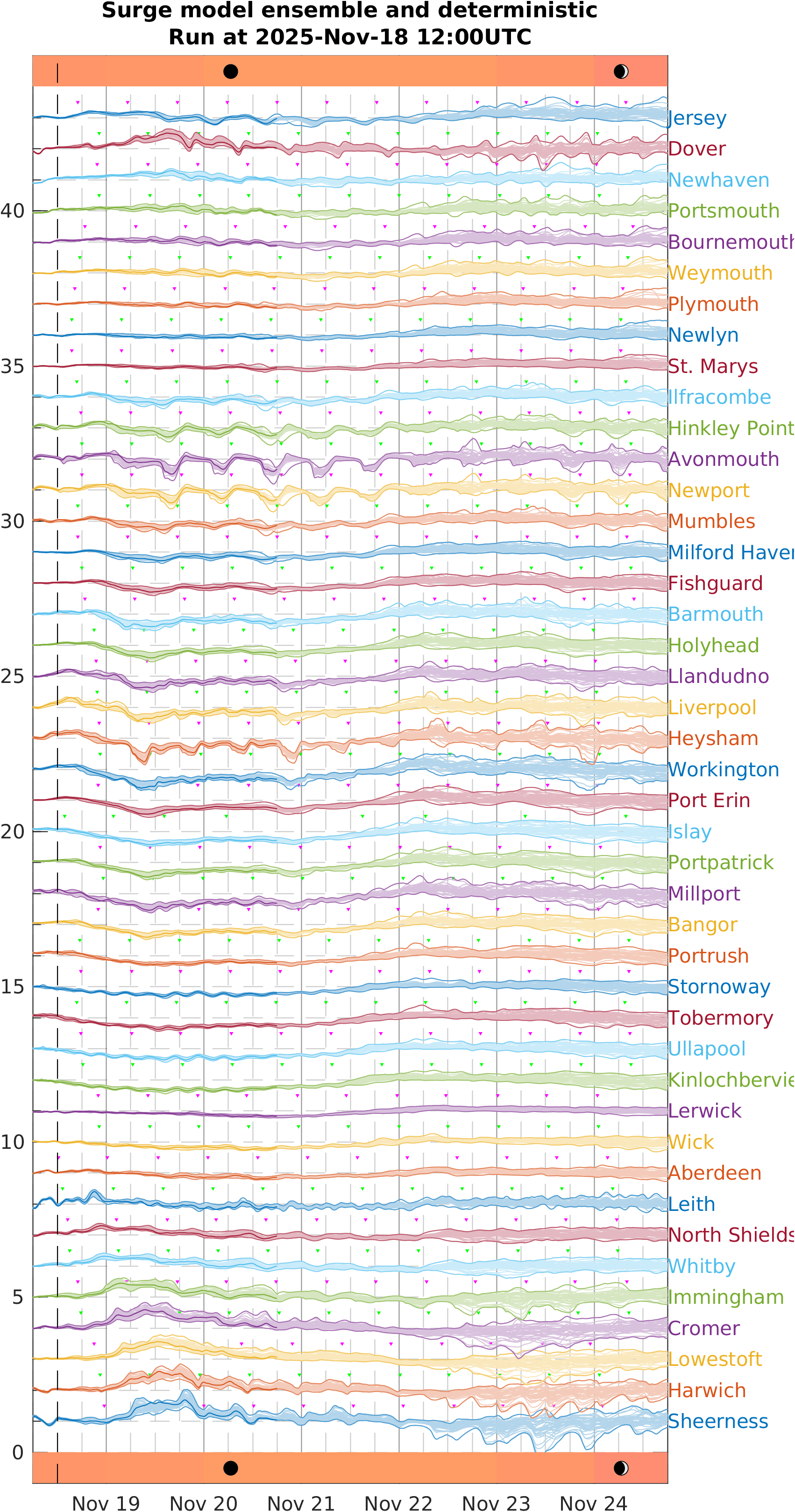
Latest ensemble forecast
There are 36 results for each site, and there is an offset of 1 metre between each site. The variable shown here is surge residual, so for total water levels it must be added to the tide predictions. Also marked on the plot are the times of high water at each site as magenta or green ▴ triangles.
Phases of the moon are provided, and the pink-yellow bar indicates the approximate spring-neap tidal cycle. Spring tides (yellow), which follow full and new moon, are in general larger than neap tides (pink) which following the waxing or waning half-moon. Hence a large surge residual combined with a spring tide would be a cause for particular concern.